
Chegada de frente fria deve provocar temporais no Rio Grande do Sul a partir desta terça
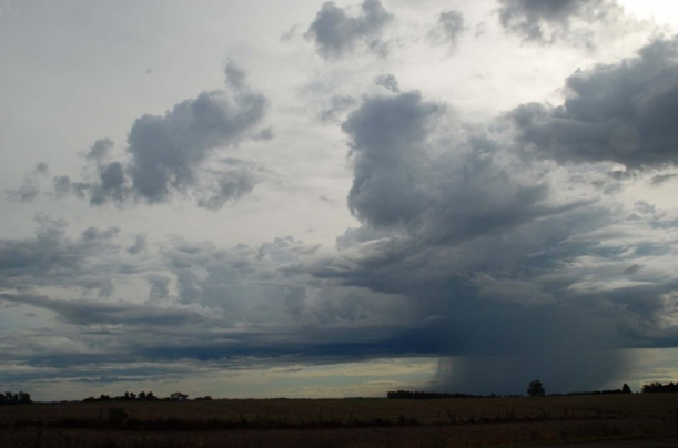
O cenário de tempo bom no Rio Grande do Sul deverá se modificar entre esta terça e quarta-feira. Segundo a MetSul Meteorologia, uma frente fria deverá causar temporais na maioria das regiões gaúchas, uma condição que se estenderá para Santa Catarina e Paraná. No Estado, os maiores volumes de chuva devem ser registrados na Metade Oeste, área que poderá receber acumulados entre 30mm e 50mm. Já em pontos do Leste, as precipitações poderão somar apenas entre 10mm e 30mm.
Com a possibilidade de temporal, há também o risco de queda de granizo e de vendavais. O deslocamento muito rápido da frente e o fato de preceder uma massa de ar frio de maior intensidade acentuam o risco de vento forte. O potencial para vendavais fortes será alto, dentre outras regiões, na Metade Oeste gaúcha com rajadas perto ou acima de 100 km/h em pontos isolados.
De acordo com a MetSul Meteorologia, a frente fria irá avançar no Estado com grande velocidade. Por conta da presença de ar quente na sua dianteira, nuvens carregadas poderão se formar. A quarta-feira será chuvosa em Porto Alegre e no interior a instabilidade irá durar até o período da noite.
Antes da chegada da chuva, as máximas em várias partes do Rio Grande do Sul irão ultrapassar os 30ºC.
Autor: Rádio Comunidade
Data da Postagem: 29/03/2022 16:02:00
Fonte: Correio do Povo / Foto: Fernando Dias/SEAPDR
Leia também
-
Governo antecipa décimo terceiro de aposentados e pensionistas
-
Prazo para aderir ao parcelamento do IPVA 2024 se encerra na quarta (31)
-
Alpestre: Brigada Militar apreende mais de R$ 250.000,00 em espécie
-
Adolescente salva irmã, mas morre afogado no interior de Chapecó
-
Motocicleta furtada em Frederico Westphalen é recuperada em Planalto
-
Atropelamento deixa vítima fatal em Ametista do Sul
-
PRF apreende mais de meia tonelada da drogas escondida em caminhão na BR 386
-
Congresso derrota governo e retoma Marco Temporal para demarcação de terras indígenas
-
Colisão frontal acontece na RSC-472, em Tenente Portela
-
Menino de dois anos morre afogado após cair em piscina
Comunitária 87.9 FM | Todos os direitos reservados.
![]()